
The Great American Land Bubble
Chapter IX. Louisiana Spanish Grants and their “Antedaters”
ON JANUARY 29, 1804, less than a year after France ceded Louisiana to the United States, Thomas Jefferson wrote to Dr. Joseph Priestley:
“I very early saw that Louisiana was indeed a speck in our horizon, which was to burst in a tornado.”
Jefferson undoubtedly did not mean a tornado of land claimants, land jobbers and land-grant thieves, but he could, with truth, have as well made this remark. The vast, boundless region—which scarce a half century before had engendered dreams of fabulous wealth creation on the part of John Law and the other promoters of the Mississippi Bubble—had hardly been taken over by the new American republic, when hosts of schemers and “get-rich-quick” adventurers began to present their “claims” to a large part, if not practically all of the territory.
Under the terms of the treaty of cession, the United States agreed to incorporate the ceded territory into the Union as soon as possible and to accord to the inhabitants “all the rights, advantages and immunities of citizens,—and in the meantime, they shall be maintained and protected in the free enjoyment of their liberty, property and the religion they profess.”
This clause meant that all land titles, land grants and other rights given by the Spanish and French administrators must receive recognition in so far as they did not conflict with the principles of the Federal Constitution.
Just as soon as the Louisiana Purchase became known, land speculators in the region began to get exceedingly busy. They sought out and bought up all sorts of questionable titles, grants and conveyances, and when they could not find enough of them, they manufactured them. “No sooner was it known that the province of Louisiana was sold to the United States,” wrote Moses Austin, a resident of Upper Louisiana, to Albert Gallatin, “a general and fraudulent sale of lands took place. . . . Concessions for any quantity of land were duly granted, bearing date of 1799 or further back, if the claimants demanded.—The number of acres granted was governed by the sum paid. It is not necessary to say to what extent the speculation was carried on.”1
And Rufus Easton, a Connecticut Yankee, who was one of the many Easterners who settled in St. Louis within a year after Louisiana was acquired, wrote to Jefferson in a similar vein: “About the latter end of June 1803, information arrived in this country of its cession to the United States when instructions were given to the various agents of the governor . . . that grants and concessions be dated back to the year 1799, which was the general antedate . . . and that surveys thereof would be made of any tract from fifty to fifty thousand acres to any person upon payment of one hundred dollars for five hundred acres, and so great was the thirst for speculation, when money could not be obtained, horses and other property were received for payment.”2
Because the Spanish governors had been desirous of attracting settlers to the Upper Louisiana territory, the local officials had granted free land under liberal “head rights” and “colonizing contracts.” This policy was not continued under the brief régime of the French, with the result that the dates of the fraudulent grants were set back to the Spanish period, i.e., before 1800. So freely were the Spanish grants given that some local officials were in the habit of attaching their signatures to the certificates before the amount and location of the land was noted thereon. Naturally, these sheets got abroad and began to command a price among the so-called “antedaters.” These “antedaters” were mostly Americans some of whom had emigrated into Missouri and “squatted” on land without receiving an actual grant or conveyance from Spanish officials.
The frequency of these land grants bearing date of the closing year of the Spanish régime in Louisiana was soon recognized as strong evidence of corruption and fraud. As early as February 29, 1804, President Jefferson informed Congress that “Attempts are now making to defraud the United States.” He estimated that two hundred thousand acres of land, “including all the best [lead] mines, have been surveyed to various individuals in the course of a few weeks past . . . All the official papers, relative to these lands, bear the signature of M………., the predecessor of the present Lieutenant Governor.” “To understand the nature of this fraudulent transaction,” the President added, “it will be necessary to state the mode of acquiring titles. The settler applies to the commandant by way of petition, and prays a grant of certain lands described by him. At the bottom, on the back of the same petition, the commandant accedes to the prayer, and directs the surveyor to run out the lands prayed for. This petition and order entitle actual settlers to grants on application to the proper officer at New Orleans . . . Under these circumstances, they seem to have an equitable claim to their lands and really expect a confirmation of them by the United States.”
The “M……” mentioned in Jefferson’s report undoubtedly refers to Lieutenant-Governor Zenon Trudeau, who was Spanish Commandant of Upper Louisiana in 1799, and who was living at New Orleans at the time of the Louisiana Purchase. He was induced, through bribes of speculators, to sign numerous blank sheets of paper. On these sheets the petitions for lands and the orders for surveys were later inserted by the speculators. In this way, the best lead and iron mines in Missouri are said to have been “granted” during the period when the Louisiana territory was being transferred to the United States.
Old land cessions were also resurrected and the deeds altered by erasing names. Moreover, Carlos Delassus, the last of the “commandants” of Upper Louisiana is reported to have made large grants to members of his family and to his friends. These grantees thus became the largest land holders in the region now constituting Missouri.
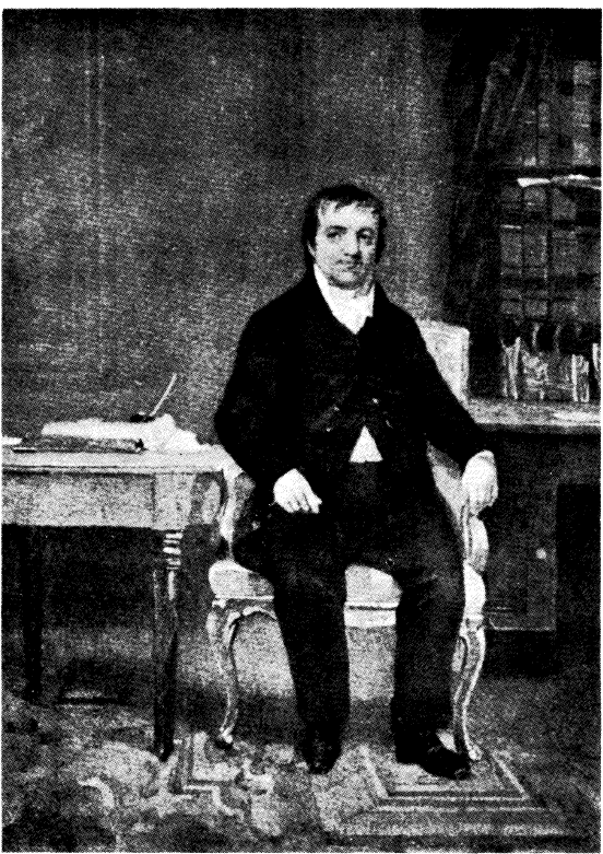
JOHN JACOB ASTOR
(From a painting by Chappel)
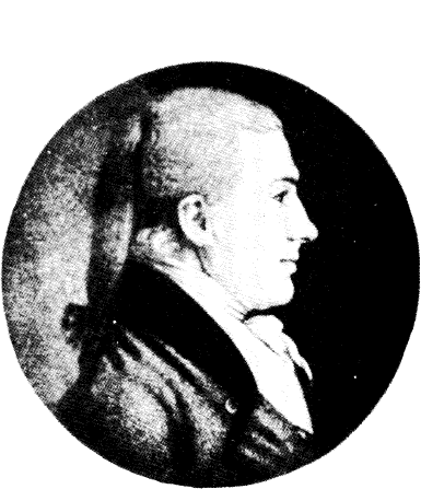
AARON BURR
(Reproduced from an engraving in the Smithsonian Institution)
Congress in 1805, upon learning of the frauds, appointed commissioners to determine the validity of Louisiana land titles. And what a difficult job they had! They required every holder of real estate obtained under Spanish and French dominion, ranging from village lots to princely domains, to prove ownership of their properties. The work extended over a period of thirty years. Corruption and fraud, threats and violence, suits and countersuits, characterized the proceedings throughout. At times, the land commissioners suffered bodily attacks, and the lawless spirit and greed for land made it necessary for them to carry arms for their personal protection.
The land grant controversies entered prominently into local politics in Missouri. The fiery Thomas H. Benton, grandson of Thomas Hart, notorious Yazoo and Tennessee land grabber, was appointed United States Senator from Missouri in 1820 largely because he favored liberal grants to claimants. Other politicians took the opposite view. Among these was John B. C. Lucas, Benton’s opponent, appointed by Jefferson a member of the Louisiana Land Claims Commission. Lucas’ attitude of persistent opposition to the speculators fastened upon him the hatred and ill will of many of the influential politicians; but he persisted in his policy, notwithstanding it led to his defeat by Benton in the senatorial contest in 1820.
While the government commissioners were hearing and deciding land claims, the “Spanish grants” were being hawked about among speculators. Eastern capitalists, as well as speculators on the spot, bought them up. Familiar names appear among the lists of those whose claims were denied or granted. Daniel Boone, who moved from Kentucky into Louisiana territory in 1798, and became a commandant of a district under the Spanish, claimed and was granted 1,000 arpents (about 850 acres) by Congress in 1813, though he had not cultivated or improved the land as required in the original concession. Moses Austin, who settled in Upper Louisiana in 1797, and began mining lead at Mine-a-Burton, near St. Genevieve, Mo., was finally refused title to his “square league” of land on the ground that the grant was not made and completed prior to October 1, 1800. Rufus Easton, a judge and politician, who had early informed Jefferson of the “antedaters,” also had a number of claims, which were denied confirmation. Easton’s ire, on one occasion, was so aroused by the opposition to him of one of the land commissioners, that he made a personal attack on him “with a bludgeon,” for which he was sentenced to fourteen days in jail. William Russell, a large jobber in the Spanish grants, submitted as many as 309 claims in the space of a few years, but of these only 23 were approved. John Smith T., a notorious land thief, also presented a number of claims to both small and large plots, most of which were rejected. And so the cases ran, the decisions creating both political and financial animosities, in the old Upper Louisiana country.
General James Wilkinson’s name, curiously, is not conspicuous among the Spanish land grant claimants. Wilkinson, we have already seen, had been concerned in western land deals. His integrity has been a mooted question among historians—and the fact that he was in command of American troops in Louisiana, and, together with Governor Wm. C. C. Claiborne, received the surrender of the province from the French Government, would have given him the opportunity of engrossing lands. Yet, as pointed out by his great-grandson, “one of the strongest proofs of the integrity of Wilkinson is the fact that the eight volumes of American State Papers, which contain all the Spanish land grants, and include hundreds of American settlers, do not show one grant in Wilkinson’s favor . . . Wilkinson never got enough land from the Spaniards to serve him as a grave.”3
Yet, as admitted by the ardent defender of his ancestor, one entry among the Spanish land grant claims in Louisiana shows that General James Wilkinson bought on May 12, 1816, from Moreau, the original grantee, Dauphin Island at the mouth of Mobile Bay. The American commissioners, on the application of Wilkinson’s heirs, refused to confirm the grant because he “was not allowed to hold land under Spain, not being a Spanish subject.”
The ousting of squatters was a most difficult task for the national government. Many Americans, prior to the Louisiana cession, had emigrated into the Spanish domains and had taken up lands merely on the verbal permission of the Spanish officials. These settlers, because of willingness to live under Spanish laws, were called “Hidalgos” by the Ohio people. They could furnish no evidence of title, and when ordered to remove, frequently caused disturbances. The cry of “squatter sovereignty” arose. Politicians sought offices by favoring this principle. Thus, John Scott, who in 1816 presented himself as a candidate for Congressional Delegate from Missouri,—and got the job,—boldly stated in his platform: “Neither justice or policy requires that the people of this territory should be removed from land which they have ameliorated by their labour, and defended by their bravery, before any opportunity of buying was afforded them; and indeed, before they have received the pay which the government owes them for defending even the country itself against our savage enemies.”4
Some of the Spanish grant cases were fought through the courts for many years. The litigation of Antoine Soulard for land granted him in Missouri covered a period of almost half a century. Soulard was a former officer in the French navy, who settled in Upper Louisiana and became a surveyor. He was recommended by the last French Governor, Carlos Delassus, to the American authorities, as one who could furnish the most reliable information regarding titles to Spanish grants, including those in New Madrid, the last post in Louisiana where free grants were made. Soulard and his two sons were granted more than 5,000 arpents (4,200 acres) in various parts of Upper Louisiana, by Delassus. In addition, he received a grant of 59 arpents in and near the city of St. Louis. This latter grant became extremely valuable after the American occupation. It was assigned to E. H. McCabe, who prosecuted the claim. Though in the opinion of the land commissioners the claim was valid, the United States Court finally rejected it in 1830. In the meantime the land had been sold by the United States, but in 1856 the heirs of McCabe petitioned Congress for other lands to offset their claim—and Congress finally reported favorably upon the petition.
Another and more extended claim was that known as the “Clarmorgan Grant.” Jacques Clarmorgan, a native of Guadalupe, was a merchant, fur trader, explorer, and land speculator in the Upper Louisiana territory during the Spanish regime. As a reward for “exploration services as far as the Pacific Ocean,” he petitioned, on March 1, 1797, for a tract of land “on the west side of the Mississippi River, at a distance of a few leagues above the mouth of the Missouri River and bounded by Charmette (Dardenne) Creek and the Copper River, with suitable water frontage, and extending toward the west until the ‘inland hills’ are reached.” The total acreage was estimated at 500,000 arpents (425,000 acres) and today would comprise a large part of Arkansas, just below New Madrid. The petition, it was claimed, was granted July 3, 1797, by Baron de Carondelet, Governor-General of Louisiana. In addition, Clarmorgan acquired other immense tracts in the same region along the Missouri and Mississippi rivers. The total acreage of his lands was estimated at about one million arpents. Land speculation, however, was not his only business. He was the promoter of the Missouri Fur Company in St. Louis, which traded extensively with the Indians. After the American occupation, he became a judge in the Louisiana territory. But his fur company proving unsuccessful, he left St. Louis after a few years and settled in Mexico. His land claims were then assigned to others “as his legal representatives.”
For many years, these “legal representatives,” “trustees” and “assigns,” as they variously called themselves, sought confirmation of Clarmorgan’s grants, stressing particularly the claim for the 500,000 arpents near the mouth of the Missouri River. Congress appears to have paid little heed to the repeated petitions for recognition of the claim, though the settlement of the region was retarded for a time because of its existence. The land was finally surveyed and opened to public entry and, because of its desirability, was soon taken up by settlers.
The federal commissioners again and again considered the question of the validity of the Clarmorgan grants. In their final report made August 25, 1835, they stated that “the great importance of this claim has induced the commissioners to make a consideration of every fact connected with it.” And they concluded that this grant to Clarmorgan was never validated by the officers of the Spanish Government, and was abandoned by the claimant himself soon after it was obtained. Moreover, when the Surveyor-General of the United States made his surveys in the territory, he was not notified of the claim. “These circumstances induced the board to believe that the claimant abandoned his claim with the knowledge of the officers, to seek remuneration otherwise; or has been guilty of the neglect of his privileges under the grant. . . . The board, therefore, could not recommend this claim for confirmation.” Despite this rejection, speculation in the claim continued.
A peculiar interest is attached to the proceedings with reference to the Clarmorgan Claim, because of the participation of Daniel Webster. In spite of the repeated refusals of Congress to confirm the grant and the final adverse decision of the Board of Land Commissioners, there was formed in 1837 the “Clarmorgan Land Association” to take over the title. Like other land-grabbing concerns, the association was not incorporated, but it had a president and board of directors composed of prominent individuals. William A. Bradley was president, the “Hon.” D. Webster, Senator, and the “Hon.” S. L. Southard, formerly governor of New Jersey, were directors. The “association” took over title to the claim from John Glenn and Charles M. Thurston, Baltimore capitalists, who purchased it from Pierre Chouteau. It issued 536 “shares,” each share representing 1,000 arpents (850 acres).
The “Hon.” D. Webster gave the “association” a favorable legal opinion of the validity of the Clarmorgan grant. Moreover, the deed of trust under which the title was held by the “association” was acknowledged before Chief Justice Taney of the United States Supreme Court. All this was published in two pamphlets entitled Papers relating to the Clarmorgan Grant and The Clarmorgan Grant.
The shares of the “association” were not conspicuously offered for sale at a fixed price. In small type on the bottom of the title page of each pamphlet, there is the bare statement:
The interest in this tract is divided into 536 parts, each part, therefore, will represent the interest of 1000 arpents and a fraction,
and further;
For opinion of the present and prospective value, see paper “A” and “B,” the first by Dr. Linn, Senator from Missouri, and the other by Mr. Harrison, Representative.
In this modest way, shares in land companies were then advertised. To have boldly solicited purchasers would have condemned the proposition as a speculative land-jobbing scheme.
Success seems not to have attended the efforts of the Clarmorgan Land Association. Congress, however, continued to receive petitions to compensate the “heirs” and “assignees.” Thus, in 1848, Henry Clarmorgan, “one of the legal representatives of James E. Clarmorgan” petitioned Congress. As late as 1851 another petition was received, and a Senate Committee upheld the right to compensation and “reported a bill.”5 But there is no record that a bill was passed for a settlement of the claim, nor was the matter ever carried into the courts.
Another “Spanish grant” which was destined for many years to fill the annals of Congress, was known as the “De Bastrop Claim.” It is of considerable historical interest not only because of the persistency of its prosecution through several decades, but because it furnished the pretext of Aaron Burr’s “western expedition,” and also because it finally came into the possession of Stephen Girard, who philanthropically willed the land jointly to the cities of New Orleans and Philadelphia.
Philip Henry Neri, Baron de Bastrop, was one of the most picturesque and commanding figures associated with the early history of the Louisiana territory, and with Texas as well. He was a man of kindly, winning and magnetic personality, an adventurer who sought to undertake great things, but who met with misfortunes throughout his career. Although a native of Holland, he entered the service of Frederick the Great, becoming a member of his famous body-guard of giants. Frederick ennobled him with the title, “Baron de Bastrop,” but Napoleon confiscated his property in 1795 and compelled him to flee to America. For a time he resided in Virginia, where he carried on trading with Europe, and where he claimed to have acquired a large landed estate at Harrison, W. Va. For some reason, possibly because of failure to pay his debts or because of passing out worthless bills of exchange, he took refuge in Louisiana. Here he became friendly with the Spanish governor, Carondelet, with whom he made a contract in June, 1797, for a grant of about 850,000 acres, on the Wichita River.
Bastrop agreed to settle five hundred families on his grant. Before the families were settled, however, or before Bastrop had time to carry out his plans, the execution of the contract was suspended by the Spanish Government. He, therefore, never received a patent, though he had succeeded in mortgaging a part of the property to Abraham Morehouse, of Kentucky, whose financial assistance he had solicited in the deal.
Bastrop moved into Texas soon after the United States took possession of Louisiana. In consideration of a debt of $350,000 he deeded to Morehouse, on January 25, 1804, two-thirds of his pretended grant. The remaining third is reported to have been foreclosed in 1801, under a mortgage given in New Orleans. Or, perhaps, it was all mortgaged in New Orleans, and then sold by de Bastrop to Morehouse. The baron’s reputation for honesty in business dealings was not of the best. Haden Edwards, of Nashville, Tenn., whose Texas deals in 1827 were opposed by Bastrop, accused the baron of having borrowed $400,000 of American merchants by giving fraudulent bills of exchange on Dutch bankers, and then fleeing to New Orleans. He may have been such a scoundrel, but he has two American towns still bearing his name—one located in Louisiana and one in Texas.
Just how Aaron Burr at one time obtained a part—reported as 400,000 acres—of de Bastrop’s grant, is not entirely clear. It is fairly certain, however, that it came, either directly or indirectly, from Abraham Morehouse, since the latter, through his assignees or representatives, remained in “full and complete possession until 1846, and had even paid taxes thereon.” Colonel Charles Lynch, of Lexington, who sold the property to Burr, either obtained it from Morehouse or was acting as Morehouse’s agent.
“I have bought of Col. Lynch 400 M. acres of the tract called Bastrop’s, lying on the Washita,” Burr wrote a Mr. Latrobe in October 26, 1806. “The excellence of the soil and climate are established to my satisfaction by the report of impartial persons. I shall send on forty or fifty men this autumn to clear and build cabins. These men are to be paid in land, and to be found for one year in provisions. It is my intention to go there with several of my friends next winter. If you should incline to partake, and to join us, I will give you 10,000 acres. I want your society; I want your advice in the establishment about to be made. In short, you have become necessary to my settlement. As the winter is your leisure, I reason, if you should incline to go and view the country, you may do it at my expense.”6
It is quite evident from this letter that Burr had at least intended making a settlement on the land, even though it may have been a mere pretext, or as a base for military operations against Mexico, or in order to separate Louisiana from the Union. Burr was certainly well acquainted with land jobbing and land development schemes. We have already seen that he was concerned in one way or another in several of the great New York land purchases. He was a close friend and political associate of Jonathan Dayton, through whose instrumentality it is quite likely that he obtained knowledge of the de Bastrop tract. Dayton and General Wilkinson, we have already noted, were partners in western land deals.
Though some fifty or sixty of Burr’s men started to the Wichita River from Kentucky, nothing ever came of his purchase. It is quite probable that he made only the first payment of $5,000, and that, because of defaults in subsequent payments, the land reverted to the seller. Burr was interested enough, however, to draw a map of his “tract,” which is now one of the prized possessions of the New York Public Library.
The connection of Bastrop’s grant with Burr’s conspiracy became generally known. As illustrative of the humor of the time, a political handbill issued during Burr’s treason trial stated that “his quid Majesty [meaning Burr] was charged with the trifling crime of wishing to divide the Union and farm Baron Bastrop’s grant.” But the public was to hear more and more of the Bastrop grant long after the excitement of Burr’s treasonable designs subsided. The Louisiana land commissioners refused to confirm the claim, and the petitions to Congress were equally unavailing. Finally, the case came to the United States Supreme Court for decision, and there received a “knock-out” blow.
It came before the highest tribunal in this way: Stephen Girard was requested by the French bankers, Laffitte & Co., to collect a debt owing to them by one Carrère of New Orleans. Carrère offered 12,500 arpents of land on the Wichita, in settlement. This Girard accepted and credited Laffitte & Co. with the amount of the debt. He was glad to do this as he, in partnership with Robert E. Griffith and James Lyle, had already secretly bought, in 1822, other tracts in the Bastrop grant from the trustees of the heirs of Abraham Morehouse. They bought four-tenths of the whole tract for $21,000. The purchasers divided it into 21 shares of $1,000 each, Girard taking 10 shares. Girard, however, later increased his participation, paying 15 to 21 cents per acre, until he had in all 200,370 acres. The estate he placed under care of Judge Henry Bye, of Monroe, La., under whose direction Girard spent $42,690 improving 30,000 acres.
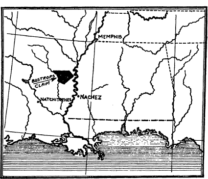
LOCATION OF THE DE BASTROP CLAIM, BASED UPON MAP IN THE U. S. LAND OFFICE
Girard thought he was making a safe investment. He wrote Laffitte & Co., on June 7, 1829, “Congress has not done anything in it [i.e., the grant] nor do I expect they will do it for some time to come in consequence of the large tracts which they own themselves in that neighborhood, and are anxious to sell. I own myself upwards of 180,000 arpents of the aforesaid tract, and have commenced a settlement thereon, where I have upwards of 30 slaves, besides overseers, and feel perfectly tranquil as it respects the nature of the title.”7 But all Girard ever received from his investment of upwards of $100,000 was a few thousand dollars from cotton and produce grown on the land. At his death he willed one-third of the tract to New Orleans, and two-thirds to Philadelphia. The city of Philadelphia brought suit for a confirmation of the grant. The Supreme Court held that Bastrop had not perfected his title, and denied the validity of the grant. The city appealed to Congress in 1859, to override the decision of the court, but no action of this kind was ever taken.
Thus ended the famous de Bastrop Grant. The Maison-Rouge Claim which was of a similar character and was also comprised in the “Washita” lands likewise never received recognition.
Another interesting and long-drawn-out claim for lands obtained originally under Spanish grants also attracted public attention for a long period of years. This was known as the Myra Clark Gaines Case. It involved, among other property, valuable real estate within and adjacent to New Orleans.
Daniel Clark was an Irishman who settled in New Orleans in 1784, when a youth of seventeen. Here he became a Spanish subject, and waxed wealthy in trade and commerce. He was politically and socially prominent, and, of course, was rewarded with liberal grants of land. He also bought up the grants of others, including the worthless Maison Rouge Claim. Among his acquisitions was a tract now in the parish and city of New Orleans which had been originally granted to Elisha Winter in 1791. The right to this land was approved by the Board of Land Commissioners in 1812. The patent was engrossed and made ready for the President’s signature, but, because of some objection, the Secretary of the Interior arrested the patent. Clark died soon after the grant was confirmed, but before its ratification by Congress. Before his death, he conveyed this New Orleans property together with all his other real estate to Joseph Belle-Chaise, with the confidential understanding that they were to remain under his control for the use and benefit of Myra Davis.
But Myra Davis was Clark’s own daughter—the fruit of a secret marriage with Madame Zubime De Granges. At least, the United States Supreme Court so decided in several suits brought before it. Her paternity was not discovered until Myra was a woman. Daniel Webster, her attorney, gave the court convincing arguments of his client’s rights to the vast estate of the crafty New Orleans politician, Congressman, and personal friend of Aaron Burr. In 1867, when Myra Clark Gaines was already an elderly woman, the Supreme Court also confirmed her legal title to the immense acreage of real estate that had belonged to her father. Some of this was recovered through suits of ejectment, but much of the wealth thus obtained by the persistent litigant was swallowed up in court costs and legal fees.
As already noted, a valuable part of the estate consisted of 700 acres adjacent to New Orleans. This had been considered as national domain and was comprised in the grant of 200,000 acres awarded to General Lafayette by Congress in 1824. Lafayette needed money, and sold the land. Thus, innocent purchasers came into possession, and when the legal ownership was decided by the court, the property was worth many millions. It was thus up to Congress and the city of New Orleans to compensate Myra. This was finally done after Myra Clark Gaines ended her litigious career in 1885.
The Myra Clark Gaines case is remarkable for the extended period of the litigation. It began in 1834 and was not settled until almost a half century thereafter. In delivering an opinion in the case in 1860, United States Supreme Court Justice Wayne remarked, “When, hereafter some distinguished American lawyer shall retire from his practice, to write the history of this Country’s jurisprudence, this case, will be registered by him as the most remarkable in the records of its courts.”
Still another case involving valuable New Orleans property attracted nation-wide interest. This was the claim to the New Orleans beach front area by Edward Livingston, Andrew Jackson’s friend and Secretary of State. Livingston was a member of the Scotch colonial clan of that name, which for several generations held, under manorial rights, most of the present Columbia County in New York. The family had a reputation for land grabbing, though Edward Livingston had become an attorney and was mayor of New York from 1801 to 1803. Thomas Jefferson then appointed him United States Attorney for the New York District. While acting in this capacity, he confessed to a shortage of public funds entrusted to him, due, as he claimed, to the dishonesty of subordinates during his illness. This led him to take refuge in New Orleans in February, 1804. The place then had a reputation as a resort for all those whose integrity had been questioned. In New Orleans, Livingston became a lawyer, politician and land jobber. Like Daniel Clark, he was friendly to Burr and became innocently involved in the latter’s conspiracy. In this way he won the animosity of General James Wilkinson, then military commander of Louisiana territory,—and, naturally, Jefferson also became prejudiced against him.
Livingston had accepted, as a fee for legal services, some water front land in New Orleans. Much of it was the result of tidal action piling up the river silt. In 1808, the United States Government laid claim to this alluviation and ousted Livingston. To get the case before the country, Livingston sued Jefferson as a citizen for trespass. Jefferson then personally took part in the controversy. In 1812 he published his pamphlet of 103 pages entitled, The Proceedings of the Government of the United States in maintaining the Public Right to the Beach of the Mississippi, etc. In this tract Jefferson took the opportunity to deny the charge that he was induced to seize the land because of malice toward Livingston.
The next year Livingston answered Jefferson in an equally vigorous manner. Livingston’s reply was a pamphlet of three hundred printed pages. Both documents attracted nation-wide interest among the legal fraternity and were reprinted in the current law journals. Livingston accused Jefferson of endeavoring to deprive him of his property, from the sale of which he expected to discharge his shortage to the government. The controversy went from Congress to the courts, and then back to Congress, It was not settled until after Livingston’s death in 1836, when his widow received a large indemnity for the appropriated lands. In the meantime Jefferson and Livingston became reconciled. On April 4, 1824, just about one year before his death, Jefferson wrote Livingston a friendly letter congratulating him because the good people of New Orleans had restored him again to the “councils of our country,” and expressing the sentiment that his election to Congress would bring aid “to the remains of our old school in Congress, in which your early labors had been so useful.”8
.....
Not all land speculations in the old Orleans country were founded on disputed Spanish and French grants. In this region, after the American occupation, town jobbing and land engrossment was as rampant as in the Northwest Territory. Towns were laid out along the rivers or at crossroads, and lot auctions were advertised widely by handbills, newspaper announcements and other means. Speculators also gambled on the probable or possible locations of state or territorial capitals or on county seats.
Thus, Stephen F. Austin, destined in after years to become the “Founder of Texas,” took up some land at Little Rock, Ark., in the expectation that the capitol of the new territory would be located there. Others interested in lands elsewhere in the territory used their political influence to oppose Austin’s selection. “Were it not for this man, Russell,” Austin wrote his brother-in-law, in speaking of one of his opponents, “our unfortunate family might yet be enabled to secure small, but decent competence, for if his opposition were removed, there would be no difficulty in getting the seat of the Government moved to Little Rock.”9 Austin’s speculation in Arkansas failed, but he was soon to take up another and more elaborate venture in Texas.
Stephen F. Austin and his family, through whom three generations of land speculators can be traced from Connecticut to Texas, also took part in the short but exciting “run-up” of what were commonly known as the “New Madrid Claims.” In December, 1811, the populous settlement of New Madrid, Mo., was visited by a severe earthquake. It tore up the land and demolished buildings. The inhabitants fled from the region, and took refuge in the outlying sections. Though not required to do so by the Constitution or the statutes, Congress in 1815 passed a measure affording relief to the sufferers. The landowners were permitted to give up their holdings in the affected region and, in return, were granted certificates entitling them to locate an equal area on government land of their own choosing.
Thus, the door for wild speculation was opened. Before the earthquake sufferers actually knew that a law for their relief was passed, a host of speculators came down from St. Louis and started to buy up their “certificates.” As the certificates gave a choice of location to the holders, they were eagerly sought after by town jobbers. The result of the rush was that of a total of 516 certificates finally issued, only 20 remained in the hands of the earthquake sufferers.
The private papers of the Austin family, then residing at Herculaneum, Mo., near St. Louis, furnish some interesting side lights on this speculation. The Austin family at the time were in financial difficulties. Their bank in St. Louis crashed and their Spanish “grant” to “Mine-a-Burton” had been rejected by the Board of Land Commissioners. Stephen Austin was, therefore, on the lookout to repair the family fortune. In his journal he noted, “I have this day given a power of attorney to W. M. O’Hara to purchase any amount of Madrid Claims and locate them for our joint account, and I have received a power from him to lay out towns and sell lots on the claims we hold jointly.”10
Austin and his partner bought the claims at the rate of from $10 to $12 per acre, payable during five years. He was so confident of a profit from his purchases that he once wrote his brother-in-law he was determined to sell all his flour “and buy Madrid claims with the money, which I will locate on my improvement in the Long Prairie.” “I advise you,” he wrote again, “to return [from Alexandria, La.] as quick as possible with all the money you can and buy Madrid claims.”
Imagine the disappointment to the speculators when William Wirt, United States Attorney-General, gave an opinion, in 1820, that the persons to whom the New Madrid warrants were issued had no right to transfer them, and that patents to the land claimed “must issue to the person who was the owner at the date of the Relief Act or his heirs.” “The Act,” he stated, “attaches no assignable quality to the charity, which it disposes. . . . It was not the intention of Congress to make these charities a subject of speculation. The law was passed to help the poor who have been rendered indigent by the visitation of God, not to enrich the speculator.”11
This thunderbolt created consternation among the land jobbers of Missouri. They made political fodder of it. As late as 1825, the General Assembly of Missouri, on behalf of the New Madrid speculators, petitioned the “Honorable Senate and House of Representatives of Congress to take the case of the claimants—[meaning, of course, the speculators]—under consideration and grant unto them such relief as justice, expediency and good policy may dictate.” Concerning the speculation in the certificates, the legislative petition frankly stated:
These certificates [for public land] have been sold and transferred for a valuable consideration from one person to another, until they have passed through the hands of many individuals of the most worthy and respectable class of our citizens, from the time that they were first issued. They were purchased with great eagerness (and when lands were high) by the new settlers coming into this state . . . who have located on them. Should the patents to the land be withheld, it would be the means of breaking up many families, and cause the ruin of many of our most worthy and respectable citizens.12
Congress, in its public land policy, has frequently shown sympathy for actual settlers, but that august body has never had a high regard for or given much consideration to petitions of land speculators. In the case of the New Madrid Claims, there was little reason to be sympathetic. An agent of the General Land Office, writing to his chief from St. Louis, November 22, 1823, expressed the view that the law for the relief of the earthquake sufferers “has given rise to more fraud and more downright villany than any law ever passed by the Congress of the United States, and if the claims are not immediately decided upon will involve the citizens of Missouri in endless litigation and trouble.”13
It does not appear that many great fortunes were founded on land speculation in the Middle West during the first decades of the acquisition of the Louisiana territory. The amount of unoccupied land was too vast. Congressman Adam Seybert, in his statistical survey of the United States, published in 1816, estimated that the government’s acreage was then in excess of 400,000,000 acres. Surveys were continuously being made by the General Land Office and settlement was being opened to lands further and further west of the Mississippi River.
In New Orleans and St. Louis and other parts of Louisiana and Missouri, it is true, there were a number of large landowners, some of whom began their acquisitions during the old French and Spanish régimes. Others acquired their estates after the American occupation. Notable among these was John McDonogh, who at the time of his death in 1850 was the largest landowner in Louisiana. McDonogh was of Scotch-Irish stock. He was born in Baltimore, December 29, 1779, and upon coming of age he took up his residence in New Orleans. Here he became a merchant and shipper, but soon his chief occupation was buying up land. He bought a number of Spanish grants in West Florida, some of which were rejected on the ground of invalidity while others were allowed. His real estate in New Orleans alone was valued in 1850 at over $2,000,000 and in addition he owned a large part of both the cultivated and the unimproved area of the State of Louisiana.
McDonogh was a queer personality. He was self-centered, industrious, patriotic, and, though somewhat miserly, liberal in his views. He was peculiarly shy of women and, therefore, never married. His three objects in life appear to have been: first, the ownership of real estate; second, the liberation of the slaves, and last, a system of free public education.
He accomplished the first with great success. He secretly fostered slave emancipation (though he himself was a slave owner) and supported the work of the American Colonization Society; and he left almost all his fortune for the support of public schools in Baltimore and New Orleans. The McDonogh School, at McDonogh, Md., near Baltimore, is supported through his bequest; and New Orleans, for almost a century, has used the McDonogh fortune in aid of public education.
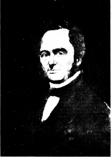
MOSES AUSTIN
(From a portrait in the Jefferson Memorial Library, St. Louis, Missouri)
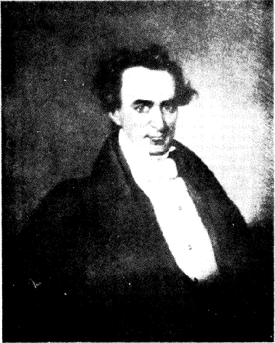
STEPHEN F. AUSTIN IN 1836
(From a portrait in the Capitol at Austin, Texas)
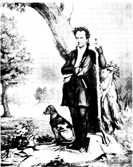
STEPHEN F. AUSTIN IN HUNTING COSTUME
(Reproduced from Eugene C. Barker’s, The Life of Stephen F. Austin)
McDonogh never really speculated in land. Like John Jacob Astor, he bought to hold, and it is said of him, that he rarely offered property for sale. Yet he did little to improve his real estate holdings. He seems to have invested his money upon the principle that time and the increase of population in Louisiana would vastly augment the value of his property. Accordingly, at his death the buildings on his New Orleans property were exceedingly dilapidated. There was, moreover, in the neighborhood of New Orleans at that time a quantity of land belonging to his estate that was still covered by the original forest, though it could have been cut up into building sites and farms and sold at a handsome profit to him. Vincent Nolte, a German trader, who was conspicuous in New Orleans business affairs, thus describes McDonogh in his reminiscences: “McDonogh talked very little, and seldom mixed in general conversation, especially with ladies, whose society he avoided as much as possible. When he did open his lips, all that fell from them was the praise of certain lands he had just purchased, and this theme was inexhaustible. It was not in Louisiana alone that he carried out his system, but in the neighboring states, and he continued it for more than forty years.”14
Congress gave Napoleon $15,000,000 for the Louisiana territory. It was a lot of money in those days. And there were many who doubted that the region was worth the price. Aside from the districts of New Orleans and St. Louis, and a few other scattered settlements along the Mississippi River, the whole domain was then a boundless wilderness infested by savage Indian tribes.
All this was changed within a few years after the American flag was raised in New Orleans. The onslaught of speculators, lawyers, politicians, pioneers and adventurers converted much of the barren empire into thriving and progressive farms and communities. Hardly a decade after the United States came into its possession, the combined wealth of a few individual newcomers exceeded the whole purchase price paid by the national government. Much of this was acquired through prudent urban real estate speculation and town jobbing. Immigrants from the East, such as John McDonogh, Edward Livingston and John B. C. Lucas, waxed wealthy in their real estate deals. Lucas alone, notwithstanding his hatred of the “antedaters” and land thieves, acquired a large portion of the present city of St. Louis. A tract of land here which he originally purchased for about $700 was in a few decades worth several millions. Like Astor, Longworth and McDonogh, he did not sell but left his estate intact for his heirs. These founded the private banking house of Lucas & Co. for many years one of the leading concerns of its kind in the Middle West.
15 The Austin Papers, Part I, p. 117.
16 Quoted in Louis Houck, History of Missouri, Vol. III, p. 36.
17 Louisiana Historical Quarterly, Vol. I, No. 2, pp. 104, 105.
18 Austin Papers, Part I, p. 258.
19 Senate Report #354, 32nd Congress, 1st Session.
20 Wandell and Minnigerode, Aaron Burr, Vol. II, pp. 87, 88.
21 John B. McMaster, The Life and Times of Stephen Girard, Vol. II, p. 409.
22 Jefferson’s Works, edited by H. A. Washington, Vol. VII, p. 342.
23 The Austin Papers, Part I, p. 359.
24 The Austin Papers, Part I, p. 337.
25 American State Papers, “Public Lands,” Vol. III, p. 494.
26 Ibid., Vol. IV, p. 155.
27 Ibid., p. 47.
28 Vincent Nolte, Fifty Years in Both Hemispheres, p. 86.
- 1Maine Historical Collections, Vol. II, pp. 268-294.
- 2The Sir William Johnson Papers, Vol. V, p. 129. See also, C. W. Alvord, The Mississippi Valley in British Politics, Cleveland, 1917.
- 3Herbert B. Adams. “Washington’s Interest in Western Lands,” Johns Hopkins University Studies, Third Series, No. 1, January, 1885. Italics are mine.—A. M. S.
- 4Adams, op, cit., p. 58.
- 5See A. Henderson, “A Pre-Revolutionary Revolt in the Old Southwest” in Mississippi Valley Historical Review, Vol. 27, p. 198 et seq.
- 6Italics are not in the original.
- 7In a letter to William Franklin, dated May 3, 1776, Johnson asserted “it has always been my practice to avoid engaging in lands to the great loss of my family, neither have I a foot of land from the Indians.” (Sir William Johnson Papers, Vol. IV, p. 197.) The large tract north of the Mohawk Valley given him by the Canajoharie Indians in 1760 was confirmed by royal grant in 1769.
- 8See Pennsylvania Magazine of History, Vol. XIV, pp. 218, 219.
- 9See Memorial of the United Illinois and Wabash Land Companies, Baltimore, 1816.
- 10A copy of the deed is contained in American State Papers, “Public Lands.” Vol. I. The original copy was acquired by Cyrus H, McCormick.
- 11See J. P. Boyd, “Connecticut’s Experiment in Expansion, The Susquehannah Company, 1753-1803,” in Journal of Economic and Business History, November, 1931.
- 12See Publications of the Colonial Society of Massachusetts, Vol. XXV, PP. 33-38.
- 13Samuel W. Jones, Memoir of James Duane, 1852.
- 14P. H. Woodward, One Hundred Years of the Hartford Bank, p. 74. See also R. J. Purcell, Connecticut in Transition, p. 154.
- 15During the first hundred years of North American colonization, economic conditions gave little encouragement to private land schemes. Land was too plentiful. A few such enterprises were undertaken, however. Thus, as early as 1661, the Colony of Massachusetts sold to a few individuals for £400 a large tract on the Kennebec River in Maine. This became known as the “Kennebec Purchase.” The heirs held it for nearly a century without doing anything with it. In 1753, they incorporated as the “Proprietors of the Kennebec Purchase” and proceeded to dispose of their holdings. The corporation continued in existence until 1816. “The Pejebscot Company” was another Maine land deal. None of these held out promise of profit to proprietors until about a quarter century before the Revolution.
- 16In the meantime, the “Loyal Company” group was not idle; its proprietors sent Dr. Thomas Walker, of Albermarle, Va., to make a reconnaissance, and to discover a proper place of settlement. The two “companies” then became engaged in a controversy, and neither made a survey or fixed the bounds of their grants. The apparent ease with which they obtained land donations led to other schemes, and aroused an epidemic of interest in distant western wild lands. Not only was the land ownership eagerly sought after, but the establishment of new colonies, with separate and distinct governments, was planned. Favoritism and collusion infested the Virginian colonial government, due in large part to the persistence of speculators in western land grants. Lobbyists were sent to London to obtain the crown’s sanction to land-grabbing schemes and the question of the disposal of the vast western domain won from the French infested British politics. “One half of England is now land mad,” wrote George Croghan, of Philadelphia, one of the land schemers, to Sir William Johnson, on March 30, 1766, “and everybody there has their eyes fixed on this country.”
- 17I offered in my last to join you in attempting to secure some of the most valuable lands in the King’s part, which I think may be accomplished after awhile, notwithstanding the proclamation that restrains it at present and prohibits the settlement of them at all; for I can never look upon that proclamation in any other light (but this I say between ourselves) than as a temporary expedient to quiet the minds of the Indians. It must fall, of course, in a few years, especially when those Indians consent to our occupying the lands. Any person, therefore who neglects the present opportunity of hunting out good lands, and in some measure marking and distinguishing them, for his own, in order to keep others from settling them, will never regain it.
- 18Crawford “heartily embraced” the colonel’s offer. He promised shortly to set out in search of lands. “This may be done,” he said, “under a hunting scheme.” He acknowledged that other land seekers had approached him, with similar offers, “but have not agreed to any; nor will I with any but yourself or whom you think proper.”
- 19Judge Richard Henderson of North Carolina, the employer and backer of Daniel Boone, promoted the settlement of the Kentucky region and claimed ownership to a vast unsettled tract there. He organized a group of land grabbers under the name of “The Transylvania Company.” Ignoring the British interdiction against Indian land purchases, he obtained from the Cherokees in 1773 about one-half of the present State of Kentucky, and immediately began settling the land. He advertised widely for pioneers and “shareholders.” In his announcements, Henderson waxed enthusiastic. “The country [Transylvania] might invite a prince from his palace, merely for the pleasure of contemplating its beauty and excellence, but only add the rapturous idea of property, and what allurements can the world offer for the loss of so glorious a prospect?”
- 20When the British Government began to take active measures to break up land “bootlegging,” and to put a stop to dreams of riches in western territory, Virginia’s political resentment was naturally aroused. Even Thomas Jefferson, who, in later life, frowned upon speculation and land grabbing, held the view in 1774 that the land did not belong to the British king, and that it was time for the colonies “to declare that he has no right to grant lands of himself.” So he boldly wrote in the Declaration of Independence, as one of the British king’s usurpations: “He has endeavored to prevent the Population of these States; for that purpose obstructing the Laws for Naturalization of Foreigners; refusing to pass others to encourage their migrations hither, and raising the conditions of new Appropriation of Lands.”
- 21He was for it at once. “I like the project of a colony in the Illinois Country,” he wrote his son, “and will forward it to my utmost here.” He thought that Sir William Johnson’s “approbation will go a great way in recommending it, as he is much relied upon in all affairs that may have any relationships with the Indians.” But Johnson had an eye on the Indian lands himself, and besides advising others about purchases in the outlying sections, personally through gifts from the Indians engrossed large tracts, particularly in the Mohawk Valley. The town of Johnstown, N. Y., still marks the seat of his domain.
- 22Some of the members of the Vandalia Company were concerned in other western land schemes. One of these was organized in 1775 as the “Indiana Land Company,” probably the first application of the name “Indiana” to the Northwest Territory. The claim to land was based on a grant of a large tract, made November 3, 1768, in what is now West Virginia, by the Six Nations at Fort Stanwix to “Chief” William Trent in liquidation of depredations. Among the shareholders were Samuel Wharton, Joseph Galloway, Robert Callender, Levi Andrew Levi, and David Franks, all wealthy and prominent Philadelphians. The Revolutionary War did not put an end to the “claim.” Wharton in 1776 published a pamphlet, entitled-View of the Title to Indiana, in which he defended the company’s rights to the lands. In 1781, he republished this in enlarged form, under the title Plain Facts; being an examination into the Rights of the Indian Nations of America to their respective Countries and a Vindication of the Grant from the Six United Nations to Proprietors of Indiana, etc. Although Wharton pressed the validity of the “proprietors” claims, Congress then and thereafter gave little heed thereto.
- 23Notwithstanding the British Government’s edict, forbidding the private purchase of lands from the Indian tribes, William Murray, an Indian trader, and several of his business associates, in 1773 formed a plan to buy from the aborigines an immense tract of country between the Mississippi, Illinois and Ohio rivers. After a “pow-wow” lasting a month, the sale was consummated. According to the land claimants, it was attended by “many persons of both descriptions and the Indians were carefully prevented from obtaining any spiritous liquors during the whole continuation of the negotiation.” On July 5, 1773, “for a very large and valuable consideration,” the deed was delivered to the “Illinois Land Company.”
- 24Notwithstanding the British Government’s edict, forbidding the private purchase of lands from the Indian tribes, William Murray, an Indian trader, and several of his business associates, in 1773 formed a plan to buy from the aborigines an immense tract of country between the Mississippi, Illinois and Ohio rivers. After a “pow-wow” lasting a month, the sale was consummated. According to the land claimants, it was attended by “many persons of both descriptions and the Indians were carefully prevented from obtaining any spiritous liquors during the whole continuation of the negotiation.” On July 5, 1773, “for a very large and valuable consideration,” the deed was delivered to the “Illinois Land Company.”
- 25The proposition then took on a business aspect. The number of “shares” was increased, and rights to subscribe offered at from $2 to $5 per share. It attracted speculators. The shares soon rose in value. Lawyers, clergymen and politicians began buying shares. The Reverend Ezra Stiles, President of Yale College, grandfather of the poet-physician Oliver Wendell Holmes, took 2¾ shares. The Governor of Connecticut, Roger Walcott, who had become rich through local land deals, supported the project.
- 26New York, before the Revolution, also had her “land” quarrels with the other colonies. The ill-defined boundaries of the Dutch province led to constant conflicts and legal controversies with her neighbors. There was a bitter dispute with New Hampshire regarding the political jurisdiction of Vermont. New York claimed the section, but New Hampshire, in 1749, acting on the principle that possession is nine points of the law, began to make free grants to both New Hampshire and Massachusetts citizens. Whole “towns” of 23,000 acres, more or less, were granted to selected groups of individuals. It is estimated that between 1749 and 1764, Governor Benning Wentworth granted 131 townships to more than six thousand persons. Among the grantees appear the names of many prominent colonial New Englanders, who had no intention of ever settling on the lands. Samuel Adams was among them. He was known as a speculator in both Maine and New Hampshire lands in this period. The governor granted himself, in all, about 65,000 acres, and is reported to have accumulated considerable wealth from the heavy fees exacted by him for grants.
- 27Because of his land deals, while acting as the state’s attorney, Duane was the butt of political criticism. He was led to appear in person in his own defense before the state legislature in 1781. He was charged with receiving Vermont grants “under immoderate quit-rents, and excessive fees of office,” and he was also accused of “holding many thousand acres of land which had never before been granted by the Crown.” To this he merely answered that he “had never made a purchase or obtained a grant of land with any view to its sale.” He was therefore not a “land jobber.” This cleared him politically of all corruption.
- 28So popular was the western lure to the Connecticut gentry that legislation was urged to countermand it. “Young people in their plays at social gatherings marched to rude melodies which taught them to dream that toward the setting sun lay an earthly paradise with gates open to welcome them. From hill and valley the processions hurried away. Today, many of our rural towns are scarred and paralyzed by an outflow which has built up the continent to no small degree at their expense.”

