The New Deal in Old Rome
The Italian Maps
The Italian Maps
The four maps grouped before the first page of text are reproductions of the marble maps set by the Italian Government on the brick wall of the fourth-century Basilica of Maxentius and Constantine in Rome. The wall abuts on the Via dell’ Impero, the new boulevard from the Victor Emmanuel Monument to the Colosseum. The maps illustrate the expansion of the Roman domain from the Tiber settlement of the eighth century before Christ to the Empire at its greatest extent under Trajan early in the second century of the Christian era. The Roman territory is shown in white, the rest of the world in black. (Photos by courtesy of the ENIT.)
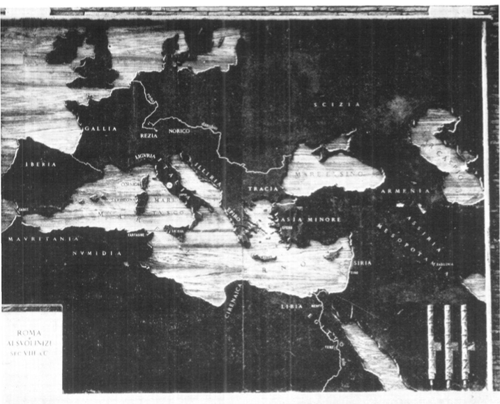
THE SHEPHERDS’ SETTLEMENT ON THE TIBER
IN THE EIGHTH CENTURY BEFORE CHRIST.
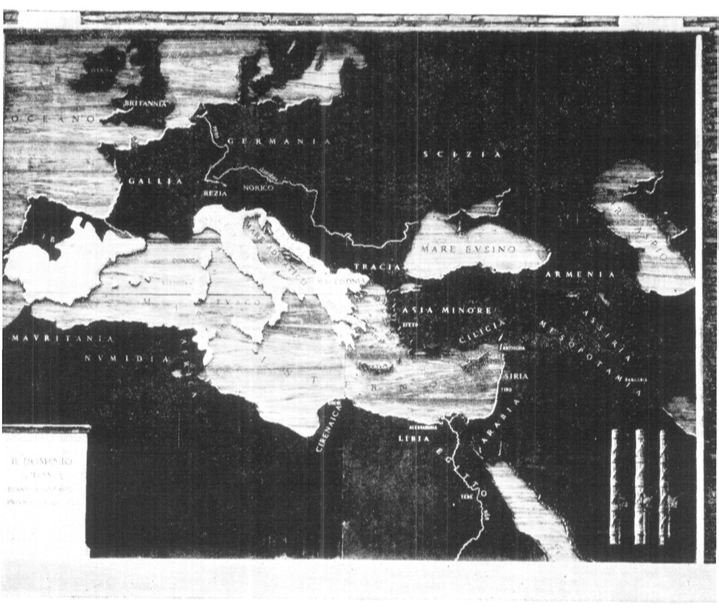
BY THE END OF THE THIRD WAR WITH CARTHAGE,
146 B.C., THE REPUBLIC HAD CARRIED ITS RULE
ALONG THE NORTHERN SHORE OF THE MEDITERRANEAN
AND ACROSS TO AFRICA.
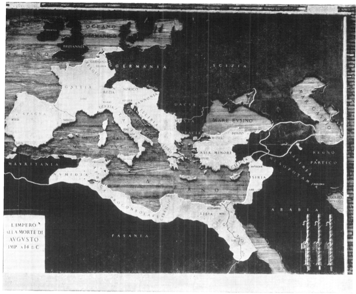
AT THE DEATH OF AUGUSTUS, A.D. 14, WESTERN AND
PART OF CENTRAL EUROPE HAD BEEN BROUGHT
WITHIN THE ROMAN ORBIT, TOGETHER WITH THE
EASTERN MEDITERRANEAN BASIN AND MUCH OF
NORTHERN AFRICA.
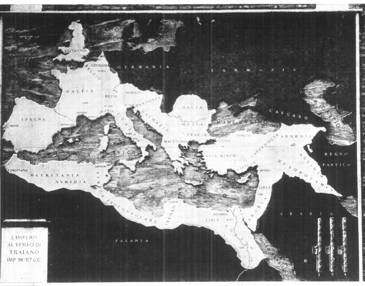
UNDER TRAJAN, EARLY IN THE SECOND CENTURY
OF THE CHRISTIAN ERA, THE EMPIRE REACHED ITS
GREATEST EXTENT. IT COVERED THE ENTIRE MEDITERRANEAN
BASIN TO THE RIVERS OF ASIA AND
INCLUDED RUMANIA AND ENGLAND.